Before you head out on your adventures, please remember to check the Important Updates and Site Marker Post Status pages for any changes to hikes, directions, or parks. You can also check the Get Outdoors Franklin! Facebook page for information.
NOTE: For an interactive map, please visit the Site Marker Hikes page and click on the blue "Locations Map" button. individual site marker pages also contain specific GPS coordinate locations.
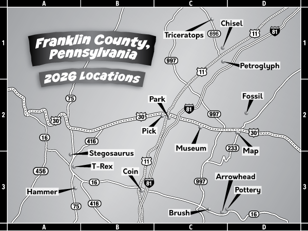
All directions were created starting from Coyle Free Library, 102 N Main Street, Chambersburg. If you are travelling from a different area, please consult a map or other means to find starting points. Hours of operations are dawn to dusk unless noted or posted.
Directions to Parking Area: Head south on N Main Street toward W King Street and take a slight right to stay on N Main Street. Turn slight left on S Main Street and turn left on Garfield Street. Turn right at the second cross street on S 2nd Street on PA-316 S/Wayne Avenue for 13.5. miles. Turn left on Main Street (Route 16 East) and travel east past McDonalds. At the next light, turn left on Roadside Avenue (road behind Waynesboro Hospital) and travel approximately 0.5 miles. Turn left on N East Avenue. Bear right at the stop sign (right turn does not need to stop) on Country Club Road. Travel approximately 0.5 miles. Turn right on Scott Drive. The destination is straight ahead.
Directions to Parking Area: Head south on N Main Street toward W King Street. Turn left at the first cross street on E King Street. Turn right on N 6th Avenue. Turn left on US-30 E/Lincoln Way E for about 9.6 miles. Turn left on PA-233 N and then left into the park. Park at the parking area on your left at the main office.
Directions to Parking Area: Head south on N Main Street toward W King Street. Turn left at the first cross street on E King Street. Turn left on N 2nd Street. Continue onto Philadelphia Avenue. Philadelphia Avenue turns slightly right and becomes College Avenue. Turn left on Edgar Avenue. Turn left on Norland Avenue. Norland Avenue turns slightly right and becomes US-11 N/Philadelphia Avenue. Continue to follow US-11 N for about 10.2 miles into Shippensburg. Turn left on N Queen Street. Turn right at the third cross street on Britton Road. Continue for about 0.75 miles (past the Ball Complex) to the park entrance on the left, before the basketball court and splash pad on the right. Park near the back corner of the parking area.
Directions to Parking Area: Head south on US-11 S/N Main Street. Turn left on US 30E/E Queen Street. for 1.5 miles. Take the exit ramp to get on I-81. Merge onto I-81 N. Drive 8.0 miles and take Exit 24, PA-696 toward Fayette Street. Turn left on PA-696/Olde Scotland Road. Continue 2.3 miles and arrive at PA-696/Dykeman Road. If possible, use the parking area on the right.
Directions to Parking Area: Travel east on E King Street, then turn left on N 2nd Street. Merge onto Philadelphia Avenue/US-11 N and continue for about 11.0 miles to PA-696 N/N Earl Street. Turn left and continue for about 5.6 miles to the park entrance on the left. Park near the main entrance, with the pavilion to your right.
Directions to Parking Area: Head south on US-11 S/N Main Street and drive 10.5 miles. Turn left on E Walter Avenue, then turn right on N Carlisle Street. The playground entrance will be on your right.
Directions to Parking Area: Head south on N Main Street. Turn right on US-30 W/Lincoln Way W for 8.6 miles. Turn left on PA-416 S for 6.8 miles. Turn left on Landis Drive. Turn right on Church Hill Road/Oregon Street and continue to follow Oregon Street. The parking area for the trail is about 300 yards on the right, just before the small bridge.
Directions to Parking Area: Get on I-81 S from S Hanover Street toward Chambersburg. Drive 18.0 miles and take Exit 29 from I-81 S. Turn left on PA-174 E/Walnut Bottom Road and then turn right on Hershey Road for about 1.0 miles. The road then becomes Neil Road in about 1.0 miles. Turn left on Cleversburg Road, then right on White House Road. This will become Baltimore Road in about 1.0 miles. Continue for 1.5 miles, then bear right on Milesburn Road. Drive 5.4 miles and then turn left on Birch Run Road. The small parking area is on the right at the trailhead.
Directions to Parking Area: From the north, take US-11 S/N Main Street through downtown Chambersburg. Stay on US 11/S Main Street, and go through the square (it turns into S after the square). Turn left on E McKinley Street, then turn left on S Harrison Avenue. Parking area is on the right behind the Chambersburg Fire Department (McKinley Street Station).
Directions to Parking Area: Head south on N Main Street. Turn right on US-30 W/Lincoln Way W for 8.6 miles. Turn left on PA-416 S. Turn left on Buchanan Trail W/N Main Street. Turn right on PA-75 S/Fort Loudon Road. Turn left on Shimpstown Road. In 0.25 miles, turn left on the gravel road. The park entrance is down this road on the right.
Directions to Parking Area: From the north, take US-11 S/N Main Street through downtown Chambersburg. Stay on US 11/S Main Street, and go through the square (it turns into S after the square). Turn right on W Washington Street. Continue past Southgate Shopping Center. Entrance will be on the right. If the gate is open, proceed to parking area. If gate is closed, park on W Washington Street along sidewalk. Park is accessible even if gate is closed.
Directions to Parking Area: Start out going south on N Main Street/US 11S toward W King Street. Drive 0.22 miles and take the third left on E Queen Street/US 30 E. Continue to follow US 30 East for 4.82 miles. Turn from Lincoln Way E on Lincoln Terrace (at white Norlo Park sign). Continue for 0.25 miles and turn right into the second parking area on the right. Park at the far-right corner closest to the swings and a pavilion.
Directions to Parking Area: Head south on US-11 S/N Main Street toward W King Street. At the roundabout, take the second exit to continue on S Main Street. Turn left on E Garfield Street (to US-11N). Turn right on S 2nd Street, then immediately bear left on Wayne Avenue. Keep straight to get on PA-316/Wayne Avenue. Travel 8.2 miles on PA-316. Turn left on Manheim Road. Turn right on PA-997/Anthony Highway. Turn left on Mentzer Gap Road. Turn left to stay on Mentzer Gap Road. The park entrance will be on your right. After entering the park, turn right and park in the lower-level gravel parking area located on the right.
Directions to Parking Area: Head south on US-11 S/N Main Street toward W King Street. At the roundabout, take the 3rd exit. Turn left on US -11 N/E Garfield Street. Turn right on S 2nd Street, then immediately bear left on Wayne Avenue. Keep straight to get on PA-316/Wayne Avenue. Travel 13.0 miles on PA-316. Make a sharp left on Orchard Road. Turn right on West Avenue. Turn right on Quincy Road. Turn left on Stottlemyer Road, then left on Gehr Road. Turn right on Washington Township Boulevard. At traffic circle, take the second exit to stay on Washington Township Boulevard. Turn left on Buchanan Trail East. Turn left on Skiway Avenue. Park in the parking area across the street from the pond.
Directions to Parking Area: Start out going south on N Main Street. Turn right on US-30W/Lincoln Way West. In 8.6 miles, turn left on PA-416 S. In 3.8 miles turn right on Lemar Road. Turn left on Orchard Road. Turn left on PA-75 S. Turn right into the main entrance of James Buchanan High School and bear right to proceed directly around the back of the building. The Center will be directly ahead. Park in the lot behind the school building.
